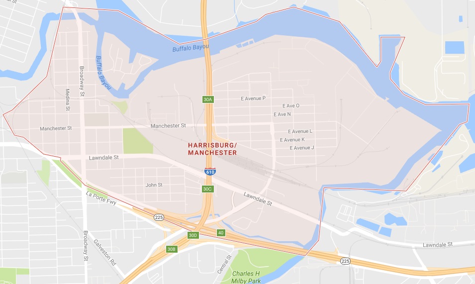
The Harrisburg area in east Houston (map data: Google)
Harrisburg is part of the East End of Houston. It is bordered by the Houston Ship Channel, south of where Brays Bayou and Buffalo Bayou meet, railroad tracks, and La Porte Road (Texas 225). It is bisected by Loop 610. Even though the area is still called Harrisburg, only a state historical marker in the 8100 block of Lawndale is all that remains of the town of Harrisburg.
Harrisburg was originally surveyed and named by John Richardson Harris in 1826. He arrived in the area in 1823. Harris named the town after himself. It was also named after Harrisburg, Pennsylvania, which was named in honor of his great-grandfather. He called the county Harrisburg, but the name was changed to Harris County in 1839.
Harrisburg was an early Texas port and trading post. It was the location of the state’s first grist mills, railroad terminal, and steam saw.
From March 22 until April 13, 1836, Harrisburg became the seat of the government of the Republic of Texas. David G. Burnet was the president. He and several of his cabinet members lived near the Harris home. While there, President Burnet chose the flag for the Texas Navy. A local resident, Mrs. Sarah Dodson, made the first tri-color lone star flag in Harrisburg.
During the Texas Revolution, on April 16, 1836, Mexican President Santa Anna and 750 soldiers attempted to capture President Burnet and his cabinet members. The soldiers burned the town. Several days later on April 21, at nearby San Jacinto, General Sam Houston defeated Santa Anna and his army and Texas gained its independence. Harrisburg was rebuilt and again prospered.
The starting point of the Buffalo Bayou, Brazos, and Colorado Railway, began in Harrisburg in 1852. This railway was the first in Texas. Harrisburg was an important rail town until the 1870 fire destroyed the rail yards. They were later rebuilt in Houston.
In December 1926, Houston annexed Harrisburg. The annexation added 1,293 acres of land to the Houston city limits, although the area is still referred to as Harrisburg.
Some of the streets that run in this area are: Broadway St., Canal St., Clinton Dr., Harrisburg Blvd., the La Porte Freeway (Texas 225), Lawndale St., Loop 610 East, and N. Wayside St.
On a trip to New Orleans, John Harris contracted yellow fever and died on August 21, 1829. He was buried in a mass grave in New Orleans, the location of which is now lost.